
Firefighters work to contain wildfires raging through Native land
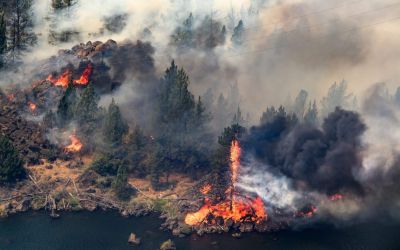
Warm weather and winds in the forecast could challenge the containment efforts. The post Firefighters work to contain wildfires raging through Native land appeared first on ICT.
Note: This story is based on the latest available information as of 2:00 p.m. PST, July 30. Please refer to your local government, fire agency websites and social media for the most timely information regarding evacuations and road closures. For information on where to donate, check with the tribes being impacted by fires on their websites and Facebook pages.
Wildfires have devastated the Pacific Northwest as Washingtonians and Oregonians watch the flames engulf their communities. In Indian Country, the fires have consumed nearly 230,000 acres. Homes have been burned, families have been displaced and the Confederated Tribes of the Colville Reservation, Confederated Tribes of Warm Springs, Confederated Tribes of the Umatilla Indian Reservation and the Confederated Tribes and Bands of the Yakama Nation are all facing evacuations.
Ripping through 129,124 acres of land in Washington as of Thursday morning, the Kaiser Canyon fire, which started on July 16 is 27 percent contained according to the latest update from the Colville Agency’s incident commander, Aaron Thompson.
The list of active evacuations hasn’t changed on the tribe’s website since Wednesday and include:
• Hailey Creek area: along State Hwy 155 on both sides of State Hwy 155 from Coyote Creek Campground to Haley Creek, continuing south to Hailey Creek Rd., then South to Omak Lake Rd. to Columbia River Rd. and then South to Kartar Valley Rd.
• Owhi Lake: Mill Creek area to Owhi Lake area to Bridge Creek Rd.
• Empire Creek evacuation zone: from South Nanamkin Rd. east to State Hwy 21, State Hwy 21 South to S Empire Creek Rd., East to the Ferry County Line, North to South Nanamkin Rd.
• Armstrong Meadows: east of Coyote Creek Rd, then north toward the Armstrong Meadows area
• Admin Hill: Charlie Williams Rd., east of Admin Hill. There is extreme danger in this area.
• Omak Lake:-east of Omak Lake and North Omak Lake Rd. to State Hwy 155, going east on State Hwy 155 both sides of the road to Haley Creek
• Coyote Creek: Coyote Creek Rd from State Hwy 155 to Columbia River Rd.
• Moses Mountain: Haden Creek Rd. in the Moses Mountain area up to the northern border of the Colville Reservation
• Central Peak: east of Moses Mountain, east to the county line, south to the Central Peak area, west to the area of Mill Creek, then north to the East Moses Mountain area
• West Fork: northwest along Gold Lake Rd. continuing to West Fork and State Hwy 21, then South on State Hwy 21 to South Nanamkin Creek Rd., west on
South Nanamkin Creek Rd. to the intersection of Central Peak Rd. and the Ferry County line, then north along the Ferry County line to Gold Lake Rd.
• Cache Creek South-: From Cache Creek Rd. South to the West side of State Hwy 21, to the east of the Nespelem Agency campus
• Nespelem area: north of Nespelem Agency, including the town of Nespelem and School Loop Rd., and both sides of State Highway 155 up to Coyote Creek Rd.
In a briefing Thursday, Operations Sections Chief Keith Kelley said he’s satisfied with the fire management taking place.
“I think things are looking really good [we’re] really trying to prepare this to the best of our ability to be able to sustain these strong winds that are going to come Saturday,” he said.
, Kelley said his team lit a preventative fire Wednesday evening to reduce fuel near Summit Lake, an area he said wasn’t prioritized because resources were needed elsewhere.